

This is an automated archive made by the Lemmit Bot.
The original was posted on /r/Ultralight by /u/smithersredsoda on 2024-09-21 04:01:11+00:00.
Thanks to Dan Stenziano for his SSHR Post, this hike has been living rent free in my mind for the last couple of months. I have spent many, many hours on this sub and want to give back a little with a trip report for a XC route with some extreme (to me) challenges but lower MPD (my schedule was based on elevation gain per day at around 3500k) and a shorter overall timeline for those of us that are new to XC.
Where: Yosemite High Route + Sierra High Route (Section)
When: 09/07/2024 – 09/12/2024
Distance: 51.79 Miles – 13247/13617 Elevation (Max Elevation 12406 – wrong peak!)
Conditions: Incredible blue skies and very windy (10mph – 15mph sustained).
Lighterpack:Link
Useful Pre-Trip Information or Overview: A 50’ish mile section hike of the Yosemite and Sierra High Route inspired by Dan Stenziano’s SSHR trip. I purchased Skurka’s Sierra High Route and Yosemite Map sets w/rudimentary gpx (more on that in the trip report). Relevant maps were uploaded to Caltopo as spatial .pdfs and color printed 11x17 double sided.
Parked at Mammoth Mountain Ski resort (Section C – mountain side) for free long-term parking and pre-purchased tickets for the YARTS 120E at 8:30am from the main ski lodge. Aside: Mammoth RV Park now charges $25 per night for overnight parking. YARTS dropped .5 miles east of the Tuolumne Wilderness permit center (halfway to the Tuolumne Store).
Yosemite permit/hard sided bear can required for Mono/Parker pass which was widely available in September. Permit pick up in-person day before/of only (no printing from home). No camping allowed from TH up to and past spillway lake.
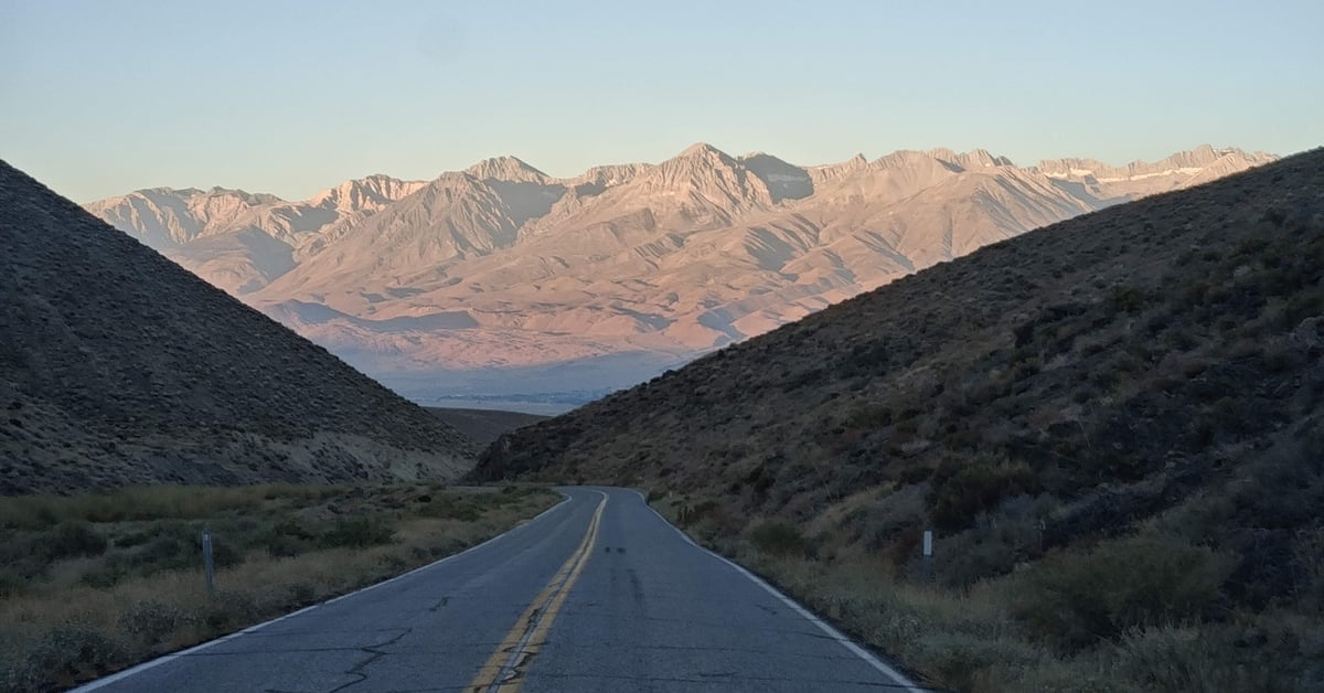
Photo Album: photos, route info and metrics: HERE
Background: I am a middle-aged male, in good condition and an experienced backcountry hiker (JMT, ALTA VIA 2) who had very limited cross-country experience. I spent many hours watching Map Reading Company YouTube videos on topographic maps, compass, micro/macro navigation. Right before this hike, I spent 2 weeks in the Sierra’s (Gem Lakes, Pig Pine Lakes) practicing XC skills. 1-5 miles at a time over increasingly difficult terrain while referencing paper and electronic maps. While this was nothing compared to the difficulties I ran into, it gave me the confidence to try this hike. My initial plan was to XC hike from TM to Donahue Pass via Kuna Crest and jump on the JMT if I was uncomfortable entering the Cathedral Range.
The Report:
Day 1 (9.4 miles/2289 elev) 75f-45f
Great experience with the ranger picking up permit “as good as it gets” were his exact words. Started down the JMT and ran into a LE ranger who was more interrogatory and kept repeating the “no camping” policy for the parker pass creek watershed. Third (mounted) ranger 200 yards further down the JMT who smiled and waved. Lot’s o rangers in Yosemite. The first 1-2 miles was on trail with XC starting in a nice meadow and lasting until reaching the Mono/Park pass trail (+/- 5 miles). I have each day’s rudimentary /gpx loaded on my garmin Fenix and overlaid on Caltopo. Quite a bit of stress mentally as I am so new, and I mostly feel the pressure on setting off on a 5-6 day trip with no trail to guide me. I reach the Mono pass trail with socks full of foxtails but no major issues. I am really mentally tired after just 5, almost flat miles. Really struggling to stay calm with no “trail” to lead the way. The next 5 miles are cruisy and end with a short 1k climb to Mono Pass. Great established site 200 yards from the small lake at pass.
Day 2 (10.75 miles/3314 elev) 65f-42f
Garmin sleep score of 71 is pretty good for me in the backcountry. I audible a XC segment towards parker pass and down a meadow that was a great alternative to backtracking to the trailhead at Spillway lake. Next segment is up to Helen Lake. My mind keeps pushing back on how to proceed, I am stressed out over willow close to waterways as it’s so damn rigid and scratchy. Helen Lake is an open bowl and the wind is really, really distracting (20mph sustained). I make my way to the Kuna Crest saddle over medium talus and it’s about 20 minutes to the top. Very relieved to see the plateau! Next 4 miles are slab, mixed talus (some near the crux are huge and quite steep), tundra and an unbelievable view west! This is the moment that the high route views kick in. Lunch is on a massive plateau with a large lake and my first siesta (30 mins) as I am normally a grind it out and sleep type hiker. Start towards Donahue and spend most of my time just soaking in the views West/South, I am no poet but these moments are etched into my memory forever. Donahue pass is covered with hikers (11 in about 20 minutes) meet up with a trio that I was in-line with for permits at TM which was awesome! I leave the JMT and look up at another what the fuck section that seems way too steep to climb. I ignore the route guide and take the section left of the spillway which is even steeper but covered in grass (no talus). Day ends at a group of (3) tarns in a wind protected (I thought) site. Almost 11 miles feels physically fine but I am mentally exhausted.
Day 3 (4.09 miles! /1787) 62f-43f
Day 3 starts early (12:30am) as I have billowing (25mph+) wind slapping the sides of my tent which eventually pullout one of the Ti hooks, although fully seated and rock’s surrounding 75% of my site. The Xmid literally looks like a set of lungs with each gust expanding and contracting to the point where it feels like an empty shopping bag caught in the wind. I climb out and find a 25lb rock that stabilizes the roof. Very, very nosy night but I get a couple more (much needed) hours of sleep. Some talus walking leads to Maclure lake (incredible blue color) and it’s really , really cold and windy. I take a moment to identify Russell pass and start my ascent.
** I am really trying to stay calm but this pass has been on my mind as the most difficult/dangerous of the hike and my lack of experience is crowding out the information in front me. I start traversing the bowl leading to the pass because I fell back on old habits of “follow the .gpx” which is really nothing more than connecting red dots on skurka’s map (he tells you not to use it for route navigation). I am scared and I am heading towards a very steep section. I follow the gps line which oddly points to a new ridge line. I ignore my earlier sighted pass and climb up, up up, looking to my left and laughing as I am now higher than I ever expected to be. I get to the top and look over to what is a shear drop off. I am not at Russell Pass and I feel sick to my stomach. I straddle the ridge with my feet and watch as my watch slowly adjusts it’s heading so that I can see that the pass is about 300 feet to my left. This is the moment I learn that a Garmin Fenix will takes minutes to display your accurate heading and my phone was much, much faster. I down climb about 100 feet and traverse towards the turret which I hoped I could use to ridge walk to the pass. I am wrong again and down climb a second time, traverse another 75 feet and finally get to Russell Pass. **
On the pass I look back and laugh out loud at how hard I have made this. Had I traveled the direct line through the bottom of the bowl (the Maclure glacier has a section missing which is exposed talus). I could have come straight up to the pass, and it would a have taken 45 min and not 2+ hours. No time to fuck around though, the descent is so steep I have to crane my neck and look straight down to get any idea of how to proceed. Luckily, it’s obvious with tables and ledges all within easy reach. The next 45 minutes are tedious steep talus down to the lake where I sit and look back still wondering how it’s possible I just climbed Russell Pass!
I walk over mixed tundra and talus past another tarn and down towards Sluggo Pass. The view is like some scene from LOTR and it’s hard to imagine that it’s real. I am done, mentally exhausted (maybe 50% as physically tired as I normally am and the end of a trail day). I can tell that I need to stop and I find a beautiful camp nestled in gully and out the wind which has been blowing all day. The campsites off trail are so much better than any I have ever found. Small bath in the lake and a couple of extra hours to try and mentally unwind. Netflix binge watch of Chappelle show was exactly what I needed.
Day 4 (7.69 miles/2600)(3800 down) 62f-45f
I wake up after a good night of sleep and try to convince myself that the most difficult part is over. Sluggo pass is an interesting set of ledges and I get in some much needed navigational practice. The view southwest of the pass is again, just incredible! It’s mixed talus and quite a bit of slick rock down towards the most beautiful alpine lake I have ever seen (Lake 10217). Shoes off and washing my socks, I look over with dread and the steep angle towards forester ridge and again wonder how it’s possible to safely climb this. This time I sight the ridge and keep it in perspective as I climb. From a distance what looks impossible becomes lined with cracks and switches, it’s steep, really steep but safe and I am at the base of Forester Ridge 40 minutes later.
**I make the exact same. gpx mistake aga…
Content cut off. Read original on https://old.reddit.com/r/Ultralight/comments/1flujkk/trip_report_long_yosemite_high_route_sierra_high/